Resorts in close proximity of Rein in Taufers.
SkiWeather.eu snow report
Rein in Taufers snow report
Trentino Alto Adige, Italy, 1635m
Upper snown/a
Fresh snow0 cm
Slopes openn/a
Lifts openn/a
Latest ski condition
Lower and upper-slope snow depth trend.
Recent snowpack movement with fresh-snow alert bars for Rein in Taufers.
Use the chart to compare base depth with recent fresh-snow signals before choosing terrain.
Integrated snowpack, fresh-snow, operation and thermal assessment.
The interpretation combines the same normalized snow facts used by the depth, slopes and lifts cards, then applies freshness and contradiction checks.
Lower snown/a
Upper snown/a
Fresh snow0 cm
Mountain accessn/a
Snowpack data limitedOperation data limitedNo material fresh snow
A reliable upper-slope snow-base assessment is not available. No material new-snow layer is reported in the current resort data. Current terrain access cannot be assessed reliably. Positive daytime temperatures increase softening and melt risk on sunny or lower slopes.
Measured lower, middle and upper-slope snow depth.
Current snow depth by terrain band, with upper slopes carrying the main snowpack signal.
1583m1709m1835m
Fresh snow0 cm
Freezing level2167 m
Snowpack data limitedNo material fresh snow
A reliable upper-slope snow-base assessment is not available. No material new-snow layer is reported in the current resort data. Positive daytime temperatures increase softening and melt risk on sunny or lower slopes.Open slopes
Open ski terrain today.
Operational terrain share from the latest snow report.
Open sharedata not available
Slopes opendata not available
Slope report limited
The open-slope share is unavailable; check the official piste list before travelling.Open lifts
Lift operation today.
Operational lift share indicates current access and terrain reach.
Open sharedata not available
Open liftsdata not available
Lift report limited
The open-lift share is unavailable; check the official lift list before travelling.Current weather facts for the resort.
A concise snapshot of temperature, precipitation, wind and freezing level; practical consequences are kept in Weather impact.
Weather
Cloudy
Temperature
4 to 6 °C
Precipitation
1 mm signal
Wind
6 km/h SE
Chance of precipitation
11%
Evaporation
0 mm
Freezing level
2167 m
The precipitation amount and probability do not agree, so the wet-weather signal has limited confidence. Use the period cards for timing.
Today’s period-by-period forecast.
Use the visible period cards to identify timing, temperature changes and the most likely wet or dry window.
Loading period forecast…
Stable timingDry daylight sequence
Morning: cloudy at about 6 °C. Afternoon: cloudy at about 4 °C. Evening: cloudy at about 4 °C. Morning, afternoon and evening form a consistently dry daylight sequence.
Tomorrow’s period-by-period forecast.
Use the visible period cards to identify timing, temperature changes and the most likely wet or dry window.
Loading period forecast…
Wettest: EveningPeak: Evening
Morning: light rain showers, around 2.2 mm at about 5 °C. Afternoon: rain showers, around 6.7 mm at about 4 °C. Evening: heavy snow, around 13.5 mm at about 5 °C. Precipitation develops in the morning, peaks in the evening near 13.5 mm and eases by the evening.
Snow accumulation
Current modelled snowfall signal.
A model map gives spatial context for today’s fresh-snow opportunity; local value still depends on altitude and exposure.
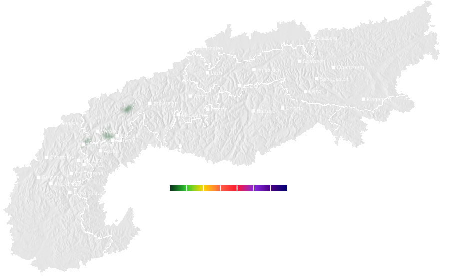
Modelled snow signal
Use this as a regional opportunity layer, then verify with resort-level depth, forecast and open-terrain data.Three-day accumulation
Short-range snowfall accumulation.
Three-day accumulation helps identify whether a single snow pulse becomes a useful short-range snow cycle.
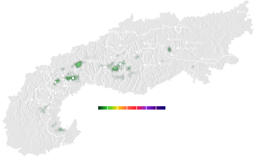
Short-range snow cycle
Use the map to compare regional snow potential with local upper-slope depth and current operations.Regional snow forecast around Rein in Taufers.
Compare the same five-day snow signal across nearby resorts to separate a local forecast from the wider regional pattern.
Regional comparison
Compare neighbouring areas before treating one resort forecast as representative for the whole region.Snow depth ski season 2025-2026
Current season snowpack history.
Snow depth development through the active ski season.
Snow depth previous ski season 2024-2025
Previous season reference.
Snow depth from the previous ski season for comparison.
Detailed historical snowResorts with comparable elevation and long-year weather profile.
Use comparable resorts to judge whether snow depth and short-range snowfall are typical for this elevation and climate setting.
Related resorts are temporarily unavailable.
What the snow means for your visit
Family progression base
Snow reliability
Long-term snow reliability: 71/100 (not current snow depth).
Compare snow conditions
Explore the resort network →Comparable long-run snow reliability and upper-mountain altitude.
Related alternative with a stronger opportunity/risk balance now. Snowpack above the weekly norm.
Related mountain with materially stronger current evidence. Supportive current weather.
Same dominant resort personality with overlapping secondary traits and comparable mountain structure.
Nearby alternative within the same broad Alpine travel radius.
8.1 km awayComparable long-run snow reliability and upper-mountain altitude.
Continue your resort check
Terrain, snow and weather for Rein in Taufers.