
When you plan a ski trip, one question matters above all others: where will the snow actually fall? At SkiWeather.eu, we don’t rely on generic weather maps or recycled forecasts. We build our own snow forecast maps from the ground up, using advanced data science designed specifically for mountain snowfall. This approach lets us focus on what skiers really need: realistic, detailed, and trustworthy snow forecasts.
From reported snow to predictive insight
Every reliable snow forecast starts with understanding how snow behaves in the real world. Our system learns from long-term snowfall patterns and historical weather data across the Alps. These observations do not represent the forecast itself. Instead, they teach the model how snow typically accumulates under specific conditions. The forecast then looks forward in time, guided by patterns that have proven realistic again and again.
Alpine micro-climates matter
The Alps are far from uniform. Some regions repeatedly pick up large amounts of snow, while nearby valleys remain sheltered or dry. SkiWeather.eu actively models these local differences using more than 10 years of weather and snow time series data. This long-term perspective allows the system to recognize snow-favored areas and typical storm behavior, improving accuracy at both regional and resort level.
Advanced snow models that keep themselves in check
At the core of the forecasting system are complex statistical models designed specifically for mountain snowfall. These models respond dynamically to changing weather patterns while automatically regulating themselves to avoid unrealistic extremes. In practice, this means the forecast can respond strongly to genuine snowstorms but will not exaggerate snowfall where the data does not support it. This self-regularizing behavior is a key reason why SkiWeather.eu forecasts remain stable and trustworthy.
Snow behaves differently at every altitude
In the mountains, snowfall depends heavily on elevation and temperature structure. SkiWeather.eu models snowfall continuously across altitude bands, factoring in freezing levels and vertical temperature gradients. This approach produces realistic rain–snow transitions, stronger accumulation at higher elevations, and more cautious snowfall estimates in lower valleys — essential information for ski planning.
Snow accumulation that makes sense over time
Snow accumulation follows physical rules. If the forecast shows 30 cm after five days, the six-day outlook should not suddenly show less snow unless melting becomes likely. SkiWeather.eu enforces this consistency automatically, ensuring that longer-range accumulation forecasts build logically on shorter ones. This makes planning trips across multiple days clearer and more dependable.
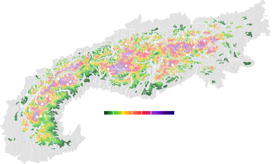
Clear maps, focused on ski relevance
Not every snowfall improves skiing. The system filters out insignificant patches and highlights snowfall that actually affects snow quality and slope conditions. The result is a clean, readable snow forecast map that emphasizes powder potential without unnecessary visual noise.
Built for confidence, not hype
Before publishing any forecast, SkiWeather.eu runs internal quality checks. When the system detects unstable or overly aggressive behavior, it recalculates the forecast using more conservative assumptions. This process keeps forecasts realistic — exciting when a genuine snow event is on the way, and cautious when uncertainty remains high.
In short, SkiWeather.eu combines long-term Alpine climate knowledge, modern data science, and strict realism checks into a snow forecasting system designed for skiers. These are not copied model maps, but carefully constructed snow forecasts you can actually plan around — whether you are chasing fresh powder or timing your next winter getaway.